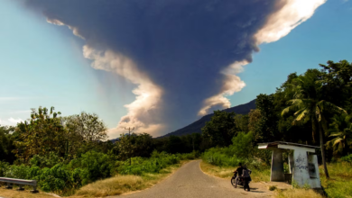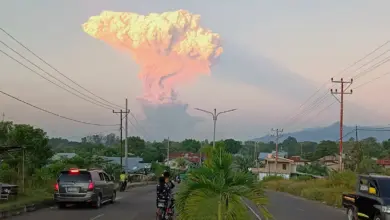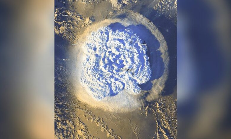
It was the highest-recorded volcanic plume and reached the mesosphere, where meteors and meteorites usually break apart and burn up in our atmosphere.
The mesosphere, about 31 to 50 miles (50 to 80 kilometers) above Earth’s surface, is above the troposphere and stratosphere and beneath two other layers. (The stratosphere and mesosphere are dry atmospheric layers.)
The volcanic plume reached an altitude of 35.4 miles (57 kilometers) at its highest. It exceeded previous record holders such as the 1991 Mount Pinatubo eruption in the Philippines at 24.8 miles (40 kilometers) and the 1982 El Chichón eruption in Mexico, which reached 19.2 miles (31 kilometers).
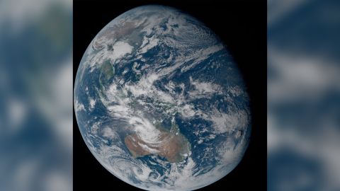
Researchers used images captured by satellites passing over the eruption site to confirm the plume’s height. The eruption occurred January 15 in the southern Pacific Ocean off the Tongan archipelago, an area covered by three geostationary weather satellites.
A study detailing the findings published Thursday in the journal Science.
The towering plume sent into the upper layers of the atmosphere contained enough water to fill 58,000 Olympic-size swimming pools, according to previous detections from a NASA satellite.
Understanding the height of the plume can help researchers study the impact the eruption might have on the global climate.
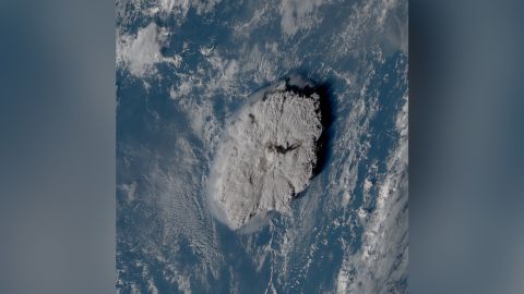
Determining the plume’s height posed a challenge to researchers. Typically, scientists can measure the altitude of a plume by studying its temperature — the colder a plume, the higher it is, said lead study coauthor Dr. Simon Proud of RAL Space and a research fellow at the National Centre for Earth Observation and the University of Oxford.
But this method couldn’t be applied to the Tonga event due to the violent nature of its eruption.
“The eruption pushed through the layer of atmosphere we live in, the troposphere, into the upper layers where the atmosphere warms up again as you get higher,” said Proud via email.
“We had to come up with another approach, using the different views given by weather satellites located on opposite sides of the Pacific and some pattern matching techniques to work out the altitude. This has only become possible in recent years, as even ten years ago we didn’t have the satellite technology in space to do this.”
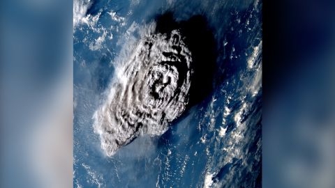
The research team relied on “the parallax effect” to determine the plume’s height, comparing the difference in appearance of the plume from multiple angles as captured by the weather satellites. The satellites took images every 10 minutes, documenting the dramatic changes in the plume as it rose out of the ocean. The images reflected differences in the plume’s position from varying lines of sight.
The eruption “went from nothing to a 57 kilometer-high tower of ash and cloud in 30 minutes,” Proud said. Members of the team also noticed rapid changes in the top of the eruptive plume that surprised them.
“After the initial big burst to 57 kilometers, the central dome of the plume collapsed inward, before another plume appeared shortly after,” Proud said. “I hadn’t expected something like that to occur.”
The amount of water the volcano released into the atmosphere is expected to warm the planet temporarily.
“This technique not only allows us to determine the maximum height of the plume but also the various levels in the atmosphere where volcanic material was released,” said study coauthor Dr. Andrew Prata, a postdoctoral research assistant in the Clarendon Laboratory’s sub-department of atmospheric, oceanic and planetary physics at the University of Oxford, via email.
Knowing the composition and height of the plume can reveal how much ice was sent into the stratosphere and where ash particles were released.
The height is also critical for aviation safety because volcanic ash can cause jet engine failure, so avoiding ash plumes is key.
The plume height is yet another emerging detail of what has become known as one of the most powerful volcanic eruptions recorded. When the undersea volcano erupted 40 miles (65 kilometers) north of Tonga’s capital, it triggered a tsunami as well as shock waves that rippled around the world.
Research is ongoing to unlock why the eruption was so powerful, but it might be because it occurred underwater.
The heat of the eruption vaporized the water and “created a steam explosion much more powerful than a volcanic eruption would normally be,” Proud said.
“Examples like the Hunga Tonga-Hunga Ha’apai eruption demonstrate that magma-seawater interactions play a significant role in producing highly explosive eruptions that can inject volcanic material to extreme altitudes,” Prata added.
Next, the researchers want to understand why the plume was so high as well as its composition and ongoing impact on the global climate.
“Often when people think of volcanic plumes they think of volcanic ash,” Prata said. “However, preliminary work on this case is revealing that there was a significant proportion of ice in the plume. We also know that there was a fairly modest amount of sulfur dioxide and sulfate aerosols formed rapidly after the eruption took place.”
Proud wants to use the multi-satellite altitude technique in this study to create automatic warnings for severe storms and volcanic eruptions.

