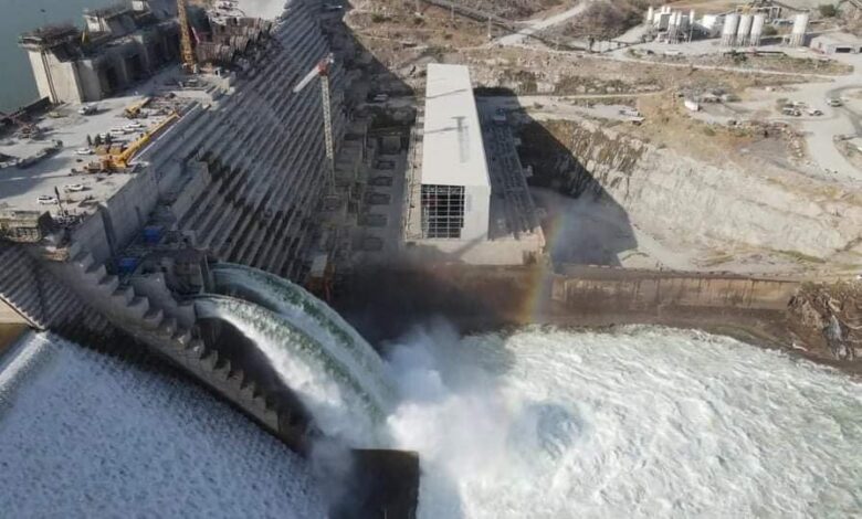
The Professor of Remote Sensing and Earth Systems Sciences at Chapman University in the US, Hisham al-Askary warned of risks surrounding the Grand Ethiopian Renaissance Dam, due to land subsidence beneath the dam.
During his speech at the fifth plenary session of the Fourth Cairo Water Week, Askary said that a research team that includes Minister of Water Resources and Irrigation Mohamed Abdel Aaty produced an important study utilizing radar technology via satellites to monitor the movement of the earth’s crust around the dam.
He explained that the GERD project consists of a concrete dam body and a rocky saddle dam, which has greatly increased the storage capacity behind the concrete dam yet may prove very dangerous to the earth crust in the area that surrounds it as it suffers from cracks in the ground.
“A synthetic-aperture radar was able to provide us with multiple data about the variation in the rates of subsidence and height of the land in the area of the construction of the Renaissance Dam from 2017 to 2021″, he continued.
Askary said that there is a clear difference in the height of the land between the eastern and western sectors of the dam, and between geological characteristics in the area of the dam’s construction in addition to the presence of weak areas under the current construction of the dam.
During the session, Askary showed satellite images that monitor a continuous vertical drop near the dam in conjunction with the first filling, which was evidenced by the appearance of waves of water at the edge of the concrete body of the dam.
The tropical rays detected a difference in the movement of water in that area.
The results of the study are concerned only with the state of the land and its movement under the body of the Renaissance and Saddle dams, and do not refer to engineering constructions that are not covered by the study, he pointed out.
The study also monitored water pollution in the Renaissance Dam Lake due to the green cover, which was also shown by satellite images via orbital rays.