More than 50 high temperature records could be broken through Monday as heat builds across the western US and Canada.
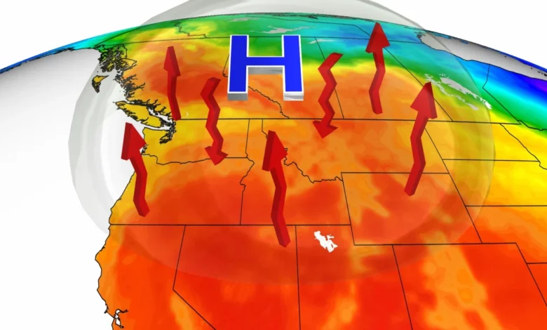
Temperatures will run as much as 25 degrees above normal, with temperatures possibly hitting 90 degrees this weekend or early next week in Seattle.
If this happens, this would be the earliest 90-degree day on record for Seattle.
Areas around Portland, Oregon, could be in record-breaking territory for four days straight, from Friday through Monday, with highs expected to climb into the 90s.
“A strong upper-level dome of high pressure will entrench itself across the Pacific NW and British Columbia this weekend,” CNN meteorologist Derek Van Dam said. “It’s really the perfect set-up for those who love summer warmth because the winds near the ground will turn offshore throughout the weekend allowing for dry, downsloping winds to spike temperatures well above average.”
Roughly 12 million people in the US are under heat alerts, including residents of western Washington, western Oregon, portions of northern California and the San Joaquin Valley.
“Temperatures in the mid to high 90’s are expected to start tomorrow and will continue through next week, with Sunday and Monday being the warmest days in the high 90’s and possibly reaching the triple digits for the first time this year,” the National Weather Service office in Hanford, California, said, about Saturday’s forecast.
The hot temperatures in the Valley will translate into hot temperatures in higher elevations too, resulting in melting snow.
“This will cause rivers and streams to run high and possibly flood. Be cautious around these rivers and streams as they will be running high and fast, and will also be very cold,” the weather service office in Hanford warns.
Overnight temperatures will also stay much warmer than normal, which won’t allow the body the relief it needs from the extreme heat. This could exacerbate heat illnesses for those without air conditioning.
The heat will stretch as far north as Canada through the weekend as well. The Canadian weather agency, Environment Canada, has issued a special weather statement warning of the extreme temperatures for portions of British Columbia and Alberta.
Temperatures will be running as much as 25 to 30 degrees above normal for some locations, reaching as high as the low 90s, which will make the ongoing wildfire problem even worse.
Wildfires continue to rage across Canada
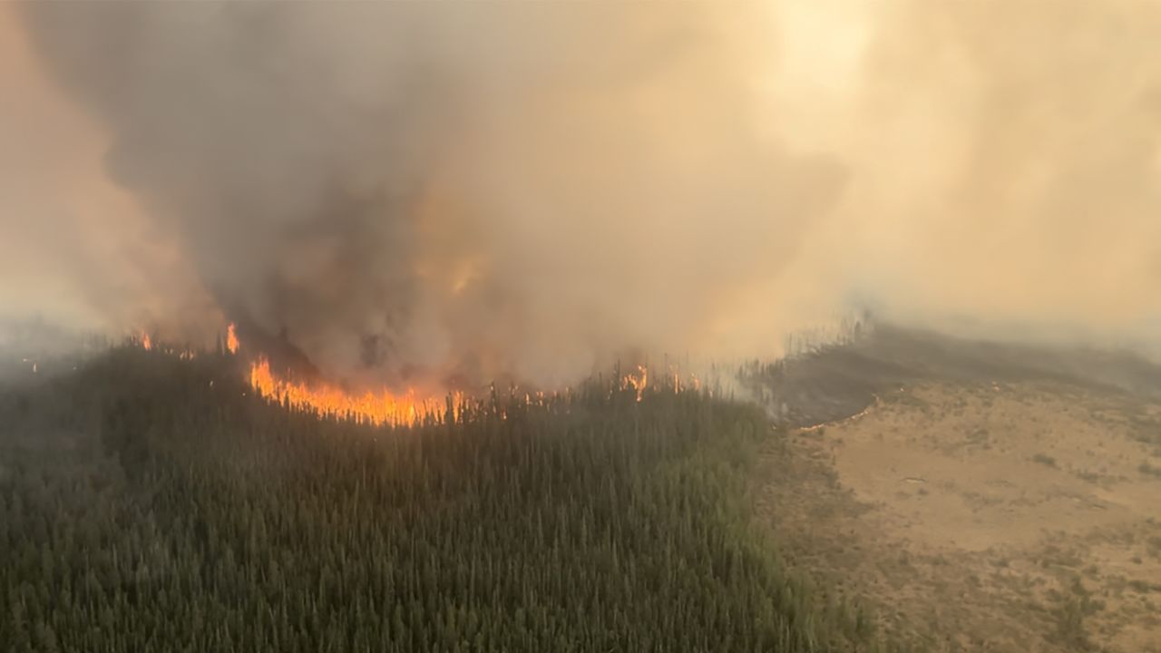
Nearly 150 wildfires are burning across Canada, 82 of which are in Alberta. The province is getting off to one of its fastest starts to the wildfire season this year, with roughly 1.1 million acres already burned to date.

“The last time Alberta had this fast of a start to the wildfire season was 2016,” Provincial Information Officer for Alberta Wildfire, Josée St-Onge, told CNN.
By this date in 2016, 488 wildfires had burned more than 1.2 million acres. By comparison, so far this year we have seen 426 wildfires, which have burned nearly 1.1 million acres.
The wildfire smoke now covers much of Canada and has even entered the Northeast US. Portions of the mid-Atlantic and Northeast are under air quality alerts, including Washington, DC and Philadelphia, as the smoke particles will be unhealthy for sensitive groups.

May is a very busy month for wildfires across Canada, and the season typically continues through the summer. If the current pace continues in Alberta, 2023 could break into the top 5 years for acreage burned by next week, with still much of the fire season remaining.
These are the five years with the most burned acreage in Alberta:
- 2019 2,182,956
- 2011 1,991,372
- 1998 1,796,372
- 2016 1,511,014
- 2002 1,226,423
This hot air is isolated in the West, as of now. Across the foothills and Rockies, temperatures will be quite different, running 15 to 25 degrees below normal.


