Hurricane Nate came ashore along Mississippi’s coast outside Biloxi early Sunday, the first hurricane to make landfall in the state since Hurricane Katrina in 2005.
The storm had maximum sustained winds early Sunday near 85 mph (140 kph) with weakening expected as it moves inland, the US National Hurricane Center said. As of 2 a.m. EDT, Nate was centered about 5 miles (10 kilometers) north of Biloxi and moving north near at 20 mph (31 kph).
At one point, Nate’s eye move over Keesler Air Force Base, where the National Hurricane Center’s hurricane hunter planes are kept, the center said.
It was Nate’s second landfall. Saturday night, the storm came ashore along a sparsely populated area in southeast Louisiana.
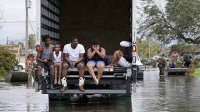
Nate’s powerful winds pushed water onto roads and its winds knocked out power to homes and business. But Nate didn’t have the intensity other storms — Harvey, Irma and Jose — had during this busy hurricane season, and people didn’t seem as threatened by it. No deaths or injuries were immediately reported.
“We left for Katrina, but we’re going to ride this one out,” Ed Nodhturft said from his Ocean Springs home.
He was hosting an impromptu family reunion after several relatives who were staying at the Beau Rivage Resort and Casino in Biloxi were forced to leave the hotel and seek shelter at his home.
During Katrina, Nodhturft’s home took on 5 feet (1.5 meters) of water from a coastal bayou. He’s in a new house, and a little worried about flooding in the low-lying area where he lives.
Hurricane Katrina made its final landfall on the Mississippi coast on Aug. 29, 2005, leveling many cities and buckling bridges. Casino barges were pushed into homes.
John Adams is a Massachusetts native who now lives on Belle Fontaine Beach, a narrow strip of land between the Mississippi Sound and a coastal marsh. Every house on the spit was destroyed by Hurricane Katrina.
“This is my first hurricane,” Adams said hours before the storm made landfall. “So far, it’s kind of a fizzle.”
Katrina was the last hurricane that made a landfall on the Mississippi coast, although both Hurricane Gustav in 2008 and Hurricane Isaac in 2012 affected parts of the coast.
Nate passed to the east of New Orleans, sparing the city its most ferocious winds and storm surge. Its quick speed lessened the likelihood of prolonged rain that would tax the city’s weakened drainage pump system. The city famous for all-night partying was placed under a curfew, effective at 7 p.m., but the mayor lifted it about an hour after it had begun when it appeared the storm would pass by and cause little problem for the city.
Still, the streets were not nearly as crowded as they typically are on a Saturday night and Mayor Mitch Landrieu asked people to shelter in place.
Some bars were closed in the French Quarter but music blasted from others.
“I don’t think it’s going to be that bad, as far as a hurricane,” said Michael Dennis of Atlanta.
Cities along the Mississippi coast such as Gulfport and Biloxi were on high alert. Some beachfront hotels and casinos were evacuated, and rain began falling on the region Saturday. Forecasters called for 3 to 6 inches (7 to 15 centimeters) with as much as 10 inches (25 centimeters) in some isolated places.
Nate weakened slightly and was a Category 1 storm with maximum winds of 85 mph (137 kph) when it made its first landfall in a sparsely populated area of Plaquemines (PLAK’-uh-minz) Parish.
Governors in Louisiana, Mississippi and Alabama declared states of emergency. The three states have been mostly spared during this hectic hurricane season.
“This is the worst hurricane that has impacted Mississippi since Hurricane Katrina,” Mississippi Emergency Management Director Lee Smithson said Saturday. “Everyone needs to understand that, that this is a significantly dangerous situation.”
Officials rescued five people from two sailboats in choppy waters before the storm. One 41-foot sailboat lost its engine in Lake Pontchartrain and two sailors were saved. Another boat hit rocks in the Mississippi Sound and three people had to be plucked from the water.
Louisiana Gov. John Bel Edwards urged residents to make final preparations quickly.
“It’s going to hit and move through our area at a relatively fast rate, limiting the amount of time it’s going to drop rain,” Edwards said. “But this is a very dangerous storm nonetheless.”
Some people worried about New Orleans’ pumping system, which had problems during a heavy thunderstorm on Aug. 5. The deluge exposed system weaknesses – including the failure of some pumps and power-generating turbines – and caused homes and businesses to flood. Repairs have been made but the system remained below maximum pumping capacity.
On Alabama’s Dauphin Island, water washed over the road Saturday on the island’s low-lying west end, said Mayor Jeff Collier. The storm was projected to bring storm surges from seven to 11 feet near the Alabama-Mississippi state line. Some of the biggest impacts could be at the top of funnel-shaped Mobile Bay.
Florida Gov. Rick Scott warned residents of the Panhandle to prepare for Nate’s impact.
“Hurricane Nate is expected to bring life-threatening storm surges, strong winds and tornados that could reach across the Panhandle,” Scott said. The evacuations affect roughly 100,000 residents in the western Panhandle.
The Pensacola International Airport announced it was closing at 6 p.m. Saturday and remain closed Sunday. However, the Louis Armstrong New Orleans International Airport was open Saturday.
Nate killed at least 21 people in Central America.