Hurricane Michael swelled to an ‘extremely dangerous’ category four storm as it rumbled toward the Gulf Coast of Florida early Wednesday in what forecasters warned was an unprecedented weather event for the area.
The National Hurricane Center said the storm is now packing maximum wind gusts of 130 mph (210 kilometers), could grow even more and is expected to slam ashore later in the day along the Florida Panhandle or Big Bend area as a “life-threatening event”.
As outer rainbands from the storm began to lash the coast, the center said a monster storm surge of up to 13 feet (four meters) is expected in some areas.
Separately, the National Weather Service office in the state capital Tallahassee issued a dramatic appeal for people to comply with evacuation orders.
“Hurricane Michael is an unprecedented event and cannot be compared to any of our previous events. Do not risk your life, leave NOW if you were told to do so,” it said.
The hurricane was forecast to make landfall somewhere along the Florida Panhandle — a finger-shaped strip of land on the Gulf of Mexico — or the Big Bend, which connects the former to the peninsula jutting south.
The storm was expected to bring hurricane force winds and heavy rainfall, the Miami-based NHC said. It will then move across the southeastern US for another day or so as it heads toward the Atlantic.
The NWS office in Tallahassee said it had searched its historical database for category four hurricanes — the second highest level on the Saffir-Simpson hurricane wind scale — that made landfall in the panhandle and Big Bend and found none. It posted a map of the coast on its tweeter feed.
“This map says it all — it’s BLANK — this situation has NEVER happened before,” the office said.
Governor Rick Scott has activated 2,500 members of the National Guard and warned Michael could be the most destructive storm to hit the Florida Panhandle in decades.
President Donald Trump issued an emergency declaration for the state, freeing up federal funds for relief operations and providing the assistance of the Federal Emergency Management Agency (FEMA).
“It is imperative that you heed the directions of your State and Local Officials. Please be prepared, be careful and be SAFE!” Trump tweeted.
State officials issued disaster declarations in Alabama and Georgia, both of which are also expected to feel the impact from the storm.
As of 0600 GMT, Michael was about 180 miles (290 kilometers) south of Panama City and moving north at 12 miles per hour (19 kph).
Flash flood, tornado warnings
The NHC said some areas of the Florida coast could expect storm surges of nine to 13 feet and as much as a foot of rain.
The heavy rains could cause flash floods, the NHC said, and spawn tornados in northwestern Florida.
About 120,000 residents were under mandatory evacuation orders in Bay County in the panhandle, a low-lying area of beachfront resorts and retirement communities.
In other areas, residents of mobile homes were urged to leave.
Michael was forecast to have the power to uproot trees, block roads and knock out power for days when it hits Florida. It is expected to weaken as it moves up into the southeastern United States.
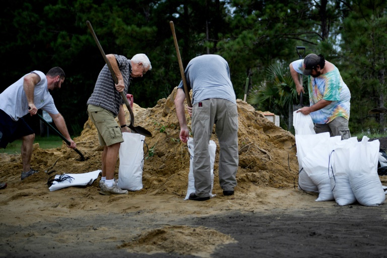
Drivers waited in long lines at gas stations and residents hurried to fill sandbags, while tolls were suspended on some roads to aid movement ahead of the storm’s landfall.
“Since 6:00 am it’s been backed up. We’re just now running out of regular (gasoline),” Danny Hess, an employee at a gas station in Panama City, told local WJHG television.
The Carolinas are still recovering from Hurricane Florence, which left dozens dead and is estimated to have caused billions of dollars in damage last month.
It made landfall on the coast as a Category 1 hurricane on September 14 and drenched some parts of the state with 40 inches of rain.
Last year saw a string of catastrophic storms batter the western Atlantic — including Irma, Maria and Harvey, which caused a record-equaling $125 billion in damage when it flooded the Houston metropolitan area.
Scientists have long warned that global warming will make storms more destructive, and some say the evidence for this may already be visible.
At their most fearsome, these low-pressure weather fronts pack more power than the energy released by the atomic bomb that leveled Hiroshima.

