More than 1.1 million people in parts of Nebraska, South Dakota, Kansas, Colorado and Wyoming were under blizzard warnings on Monday afternoon.
“Significant winter storm will ‘let it snow, let it snow, let it snow’ over portions of the Central Plains on Christmas where blizzard conditions and hazardous travel are anticipated; treacherous ice accumulations expected in the eastern Dakotas and northern Minnesota,” the National Weather Service said early Monday.
The storm is expected to bring heavy snow, freezing rain and strong winds to a large portion of the Central and Northern Plains through Tuesday, said CNN meteorologist Robert Shackelford. Widespread travel disruptions are likely across the region and wind gusts as high as 75 mph in parts of the Central Plains could mix with heavy snow to produce dangerous whiteout conditions, he said.
In the Northern Plains, heavy snow is expected through Tuesday with parts of western South Dakota likely to see an additional 8 to 12 inches.
Ice storm warnings are in effect for the eastern parts of the Dakotas and far western Minnesota until Tuesday evening, Shackelford said, with power outages and tree damage likely in areas that receive significant icing.
Street maintenance workers and snowplows hit the streets early in Omaha, Nebraska, to prepare as the holiday winter storm moved in. Much of the state was under a blizzard warning Monday afternoon, with parts of the state expected to receive 5 to 11 inches of snow and ice accumulations, as well as up to 40 mph gusts, according to the weather service.
“We will have full street maintenance staff working beginning at 3:30 a.m. Christmas morning to plow and spread salt as needed. Contractor resources are on call,” the city of Omaha said in a Facebook post.
A fleet of 40 snowplows headed onto the streets at 6 a.m., Douglas County engineer Todd Pfitzer in Omaha told CNN affiliate KETV. “You just have to be ready,” Pfitzer said. “Cause if you’re not, and it gets out ahead of you, it can really be a problem.”
Blizzard warnings also were in effect Monday afternoon for much of South Dakota. Parts of the state could receive up to 11 inches of snow, and travel could be very difficult to impossible, the weather service said.
Areas across east central and northeast Colorado, parts of southeastern Wyoming as well as northwest Kansas also had blizzard warnings in effect until Wednesday morning.
The weather service cautioned people living in areas placed under blizzard warnings to avoid traveling but if they must travel, to bring survival kits and stay in their vehicles if they become stranded.
“Due to ongoing heavy snow accumulation and high winds, driving conditions are rapidly deteriorating across the state, especially in central and north central Nebraska. Travelers are strongly encouraged to check https://511.nebraska.gov before traveling,” the Nebraska State Department of Transportation said Monday morning. The Nebraska State Patrol said travel was not recommended.
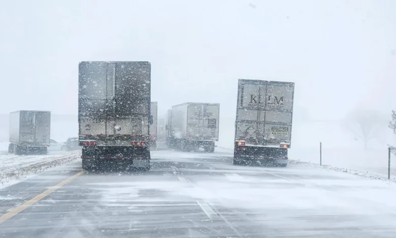
Blizzard conditions caused icy roads and low visibility in Nebraska, resulting in cars colliding and others to slide off roads. Eastbound I-80 was closed at York Monday afternoon because tractor-trailers were stuck on the road, but has since been reopened, according to the Nebraska State Patrol said.
The South Dakota Highway Patrol responded to several crashes in Watertown due to icy roads and warned drivers the ice-covered road conditions and strong winds are going to worsen throughout the day and will make driving dangerous.
The winter storm system will likely affect flights in the region, with airports including Eppley Airfield in Omaha and Sioux Falls Regional Airport in South Dakota advising travelers to check their status of their flights and consult with airlines regarding delays and cancellations.
By Tuesday night, the storm will gradually weaken as it meanders around the Central Plains. However, a wintry mix is likely to persist into Wednesday across portions of the northern Plains and Upper Midwest, CNN’s Shackelford said.
The Weather Prediction Center has issued a marginal risk for excessive rainfall for cities like Washington, DC, New York and Philadelphia for Wednesday as the storm slowly moves into the Northeast.